Two essential tools you need to geosteer your next well
The process of geosteering is perhaps the most challenging in drilling. It is mission critical and the drilling team has to leverage as many tools as possible to stay within the pay zone.
Everyone in the asset team has a role to play; while Geologists analyze offset wells, drilling engineers decide on the feasibility of wellbore geometry and the Directional Driller and MWD teams are in control of steering the well. The stakes are high and there is little room for error, being out just a few degrees can mean bypassing reservoir pay entirely.
As laterals get progressively longer it is more important than ever to bring in a team of experts and equip them with advanced applications. Geosteering success at its core relies on two things:
- generating as close to an accurate picture of the subsurface as possible and
- seamless communication between the experts.
Two Petrolink’s PetroVue apps have now established themselves as key for geosteering – Impact and Coral. When brought together they unlock a new level of drilling efficiency. Let us take a closer look at a typical well lifecycle with a focus on the benefits each app brings to the table.
Correlate in real-time
The Geosteering process differs between companies but begins long before the drill bit starts spinning. In the planning phase the asset geologists and engineers spend a good deal of time pouring over offset well logs. They are looking for common signatures between wells. At this point, all key data is on the table including well reports. Quick look correlation displays can be created in Coral and conversation channels setup in Impact ready for drilling.
Next, our clients will bring in service companies that will execute the drilling and steering plans. These are the MWD/LWD engineers who understand the nuances and capabilities of the rotary steerable tools. As communication continues Impact conversations begin. Teams start to grow and data and chats going back and forth could become unmanageable but with channels in Impact information – from chat logs to BHA images, all are catalogued under the well. This means the data is readily available and searchable; quickly at hand as the well moves to the execution phase.
Once drilling begins and real-time data starts to flow in Coral really comes into its own. When configured the active well data – LWD logs, gamma ray, resistivity and neutron logs, all stream automatically and populate the correlation panel. The wellsite geologist has overall responsibility for the steering operation at the wellsite and he or she can harness the flexibility of Coral to tweak and customize their correlation display.
As drilling progresses the operations geologist is in regular contact with the wellsite geologist, but collaboration does not need to stop there. With proper access, the LWD engineer, company, and geosteering expert can all be brought in to view the real-time data and make key decisions as the well is drilled. Leveraging as many voices as possible is crucial as each party brings their own unique experience to the table.
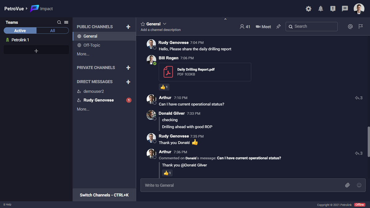
This is how it looks – Impact.
Entering the pay zone
Now in the reservoir section and all eyes are focused on the correlation displays. New tools are added to the BHA and because Coral displays are scalable, new tool outputs can be added in just a couple of clicks.
Our clients around the world are all moving to drill longer laterals and getting the data sharing right means more barrels can be booked. We have just scratched the surface on a few of the key features of Coral and Impact the best way to get a handle on them is to take them for a spin.


